Heightfield Shader - Displacement Tab
Description:
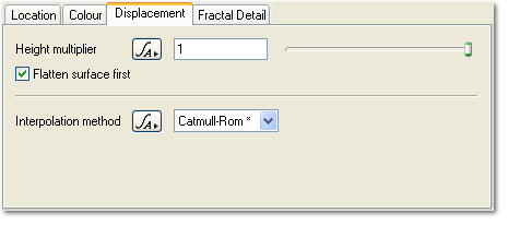
The Displacement tab controls how the values from the node connected to the Heightfield parameter are turned into displacement.
Settings:
- Height multiplier: This parameter multiplies the heights from the heightfield. The default value of 1 will leave the heights unchanged. A value of 2 will double the heights. A value of 0.5 will make them half as high.
-
Flatten surface first: If this is checked the planet surface underneath the heightfield is flattened before the heightfield displacement is applied, and the displacement is treated as absolute Y position. This has the effect of replacing all prior input surface displacement with the displacement produced by this shader and also eliminates the curvature of the planet. Border blending, Blend by heightfield and Blend by shader affect the strength of these effects. If it is unchecked, the this surface shader's displacement is additive, like most displacement shaders in Terragen. You may need to uncheck Flatten surface first if you want the heightfield to follow the curvature of the planet or if you are stitching adjacent heightfields with Stitchable border checked.
-
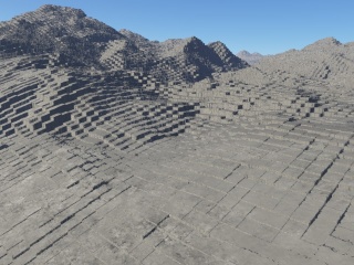
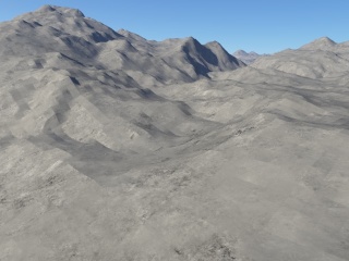
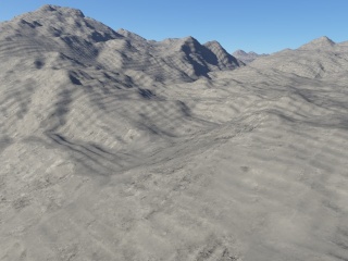
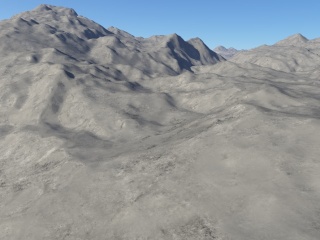
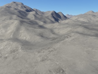
Interpolation method: This controls how the heightfield values are interpolated inbetween actual height values. The Catmull-Rom method is the default and is the best all round method. The following images show the effect of the different interpolation methods on a heightfield. Fractal detail was turned off for these images to show the heightfield more clearly. Click on any of the images to see larger versions.
Back to: Heightfield Shader
A parameter is an individual setting in a node parameter view which controls some aspect of the node.
Literally, to change the position of something. In graphics terminology to displace a surface is to modify its geometric (3D) structure using reference data of some kind. For example, a grayscale image might be taken as input, with black areas indicating no displacement of the surface, and white indicating maximum displacement. In Terragen 2 displacement is used to create all terrain by taking heightfield or procedural data as input and using it to displace the normally flat sphere of the planet.
A heightmap or heightfield is an array of height values, usually in a grid which describe the height at specific points in a defined area. Heightfields are used to represent real-world and virtual terrain in a specific, easily converted format. Most heightfields can be represented as simple image data in grayscale, with black being minimum height and white being maximum height.
A shader is a program or set of instructions used in 3D computer graphics to determine the final surface properties of an object or image. This can include arbitrarily complex descriptions of light absorption and diffusion, texture mapping, reflection and refraction, shadowing, surface displacement and post-processing effects. In Terragen 2 shaders are used to construct and modify almost every element of a scene.
