Strata And Outcrops Shader v2
Node Description & Purpose:
Displaces a surface to give the impression of hard layers of rock (strata). By using a blend shader, the hardness can be varied to give the impression of localised outcrops.
Node Type: Surface shader (displacement).
Settings:
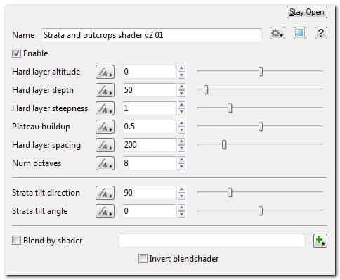
- Hard layer altitude
The altitude (in metres) of the principal layer of hard rock.
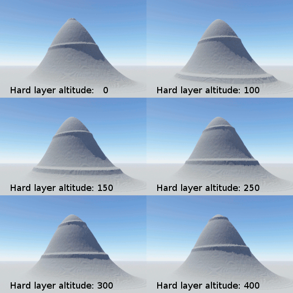
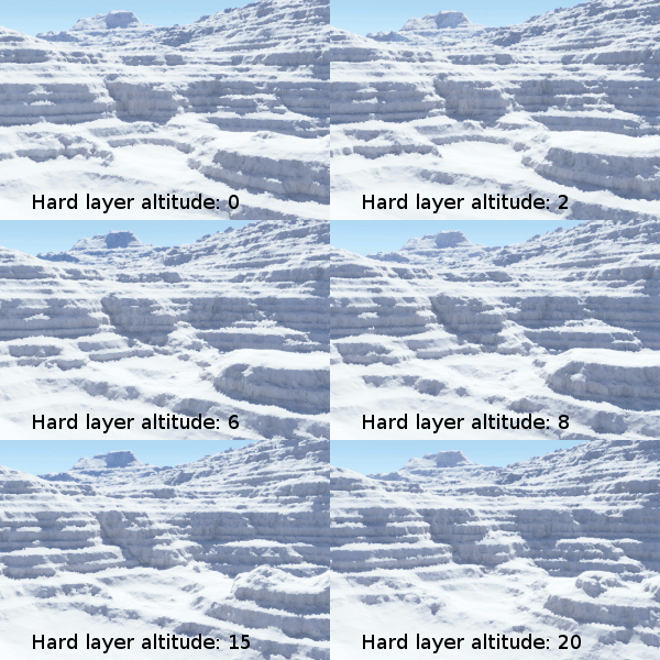
'Hard layer altitude' specifies the altitude of the top of one of the layers of hard rock. There will be additional hard layers spaced according to 'hard layer spacing', and many thinner layers that overlap the principal layers.
Parts of the surface that are below a hard layer may be steepened and raised to the altitude of the hard layer (either partially or completely). This will only happen to surfaces that are within a certain range of altitudes below the hard layer. That range is specified by 'hard layer depth'. - Hard layer depth
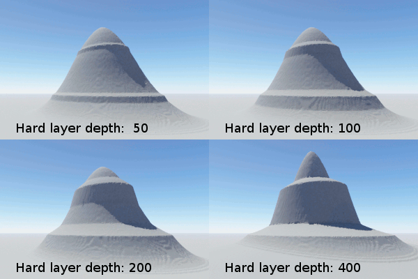
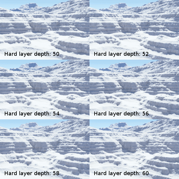
The depth or thickness (in metres) of the principal layers of hard rock.
The recommended value is about 1/4 of the 'hard layer spacing', because this allows room for plateau buildup.
'Hard layer depth' specifies the thickness of each of the principal layers of hard rock. There are many hard layers, and some are thinner than the principal layers, but the thickness of the principal layers is specified by this 'hard layer depth' parameter. - Hard layer steepness
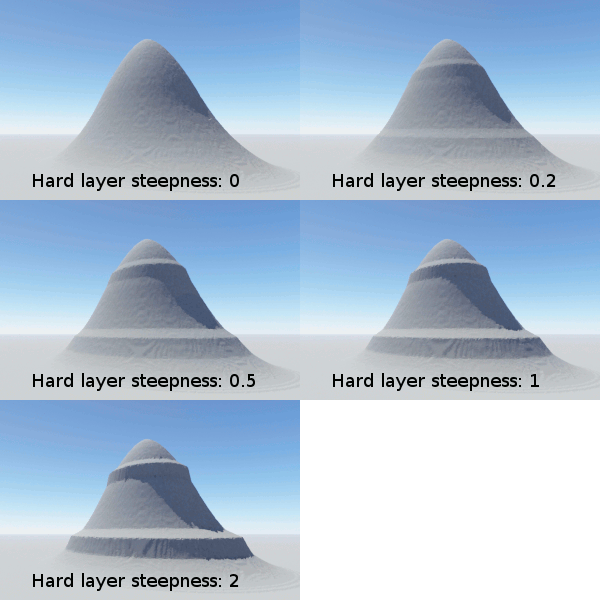
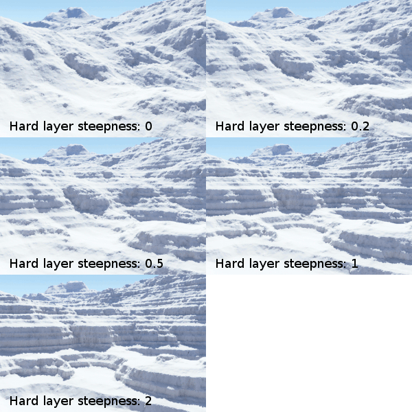
Controls the steepness, or hardness, of the hard layers of rock.
Higher values give more extreme strata.
Parts of the surface that are within range of a hard layer will be made steeper so that they rise more quickly to the top of the hard layer.
If 'hard layer steepness' is 0, the layers will not be visible. With a value of 1, surfaces within the hard layer will be twice as steep as those outside.
With steeper surfaces, the plateaus above the hard layers will be larger. - Plateau buildup
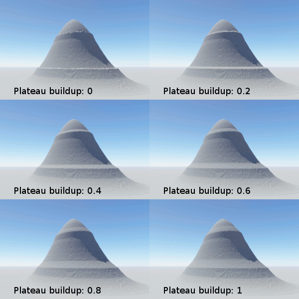
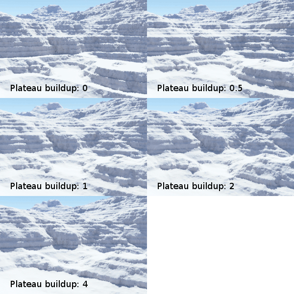
Controls the steepness of the material that builds up above each hard layer.
Lower values give more extreme strata.
Parts of the surface that are above a hard layer, but outside the range of the next highest layer, are called 'plateaus' by this shader.
To make the plateaus completely flat, set 'plateau buildup' to 0.
A value of 1 (usually, but depending on settings) allows some of the original surface shape to be kept, and a ramp is formed between the edge of the plateau (the edge of the hard layer) and the bottom of the next highest layer of the same scale.
Values in between 0 and 1 create a more level ramp that only extends part way to the next hard layer of the same scale. Flatter plateaus give a more extreme look to the strata. - Hard layer spacing
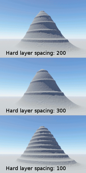
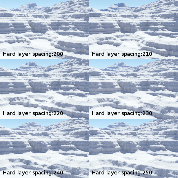
The altitude difference (in metres) between the principal layers of hard rock.
The recommended value is about 4 times the 'hard layer depth', because this allows room for plateau buildup.
'Hard layer spacing' specifies the altitude difference between the tops of each principal hard layer. There are many hard layers, and some are thinner than the principal layers and separated by a smaller distance. However the distance between the largest, principal layers is specified by this 'hard layer spacing' parameter. - Num octaves
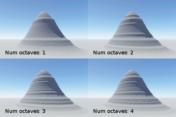
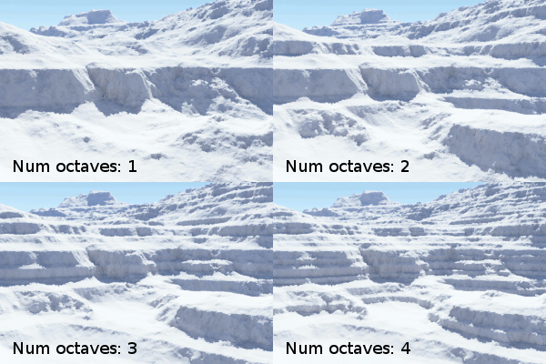
The number of 'octaves' (different scales) of hard layers. Higher values give finer details.
Each octave adds layers that are twice as small (and twice as close together) as the octave before.
There are many hard layers of the principal scale. In addition, there are smaller scales to add detail, and the level of detail is controlled by the number of octaves, 'num octaves'.
Each octave adds an additional smaller scale, twice as small as the octave before. For example, 6 octaves means the finest layers are 32 times as thin and closely packed as the principal layers, and 8 octaves means the finest layers are 128 times as thin and closely packed as the principal layers. - Strata tilt direction
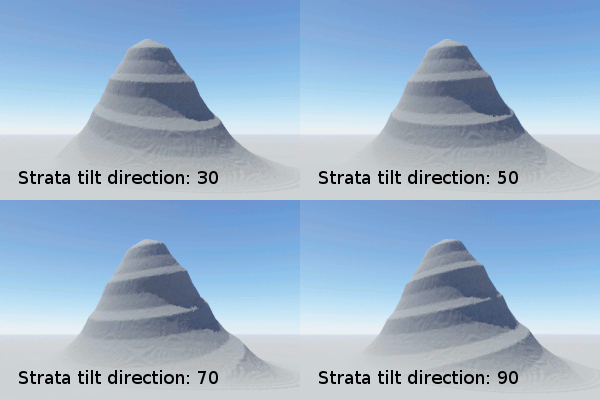
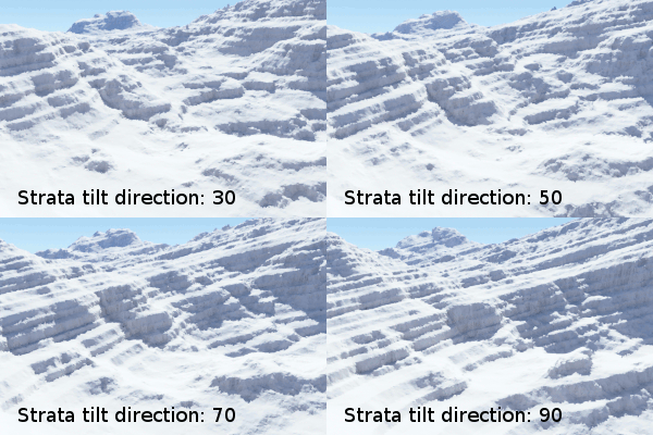
The compass heading (in degrees) along which the layers tilt upwards.
This parameter sets the direction, not the steepness.
The layers can be made to tilt, rather than being perfectly level. The tilt direction sets the angle along which the strata tilt upwards, ie. the direction you would walk if you were walking uphill along one of the hard layers of rock.
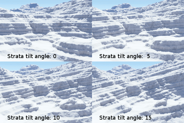
The actual steepness is controlled by the other parameter, 'strata tilt angle'. - Strata tilt angle
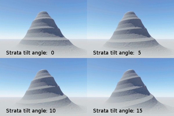
The slope angle (in degrees) at which the layers tilt upwards.
This parameter controls the steepness, not the direction.
The layers can be made to tilt, rather than being perfectly level. The tilt angle controls how steeply the strata tilt upwards.
To tilt the strata downwards, enter a negative value. This has the same effect as keeping a positive angle while adding or subtracting 180 degrees to the current 'strata tilt direction'.
A shader is a program or set of instructions used in 3D computer graphics to determine the final surface properties of an object or image. This can include arbitrarily complex descriptions of light absorption and diffusion, texture mapping, reflection and refraction, shadowing, surface displacement and post-processing effects. In Terragen 2 shaders are used to construct and modify almost every element of a scene.
Literally, to change the position of something. In graphics terminology to displace a surface is to modify its geometric (3D) structure using reference data of some kind. For example, a grayscale image might be taken as input, with black areas indicating no displacement of the surface, and white indicating maximum displacement. In Terragen 2 displacement is used to create all terrain by taking heightfield or procedural data as input and using it to displace the normally flat sphere of the planet.
A parameter is an individual setting in a node parameter view which controls some aspect of the node.
