


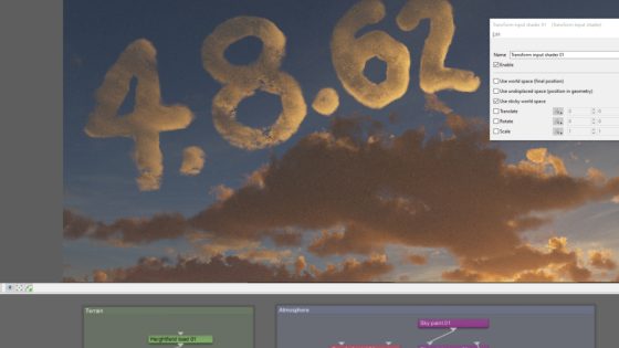
Terragen 4.8.62 Release
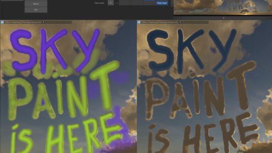
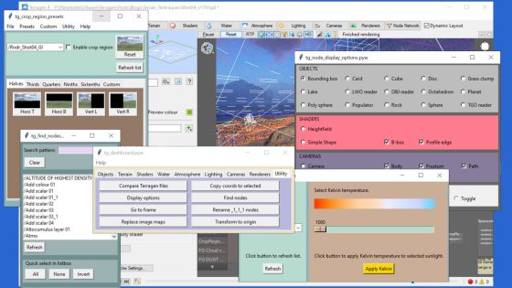
https://planetside.co.uk/wp-content/uploads/2025/08/TG4862Release_FeatureImage.jpg 1080 810 Planetside Software Planetside Software https://planetside.co.uk/wp-content/uploads/2025/08/TG4862Release_FeatureImage.jpgThis is an update to Terragen 4.8 to fix some bugs that have come to light. You can find the original 4.8 release here. Important Bug Fix: Clouds in Path Tracer There…
read more